•  

Storm Kathleen Brings Strong Winds, High Waves To Ireland, UK Coasts 2

Storm Kathleen brought strong winds to Ireland, Northern Ireland, Scotland and parts of western England on Saturday, April 6. Videos posted on social media show big waves hitting the coasts across the regions.

  •  
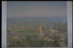
A distant view of the city of Kobe

A distant view of the city of Kobe

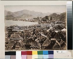
View of Kobe harbour from Mt. Suwa. Mid-Meiji Period. This is the same as photograph #4871, although the tinting of the buildings is different. The Kodera family residence is visible, surrounded by walls on the right of the main street running north-south. The area beyond the residence and to the left (east) is the present-day hub of the Hyogo Prefecture administration and site of both the Prefecture Office and Prefecture Police Headquarters. The photograph, taken about 20 years after the opening of Kobe port, shows the town expanding from the coast to the mountain side.==Date:unknown, Place:Kobe, Photo:unknown, (Credit:Nagasaki University Library/Kyodo News Images) [Cabinet Number88‐1‐0]

  •  
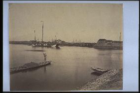
A view of Sakurajima Volcano from the harbour

A view of Sakurajima Volcano from the harbour

This photograph depicting the battery of Satsuma and a distant view of Sakurajima was taken by Uchida Kuichi when the photographer accompanied Emperor Meiji on his trip around western Japan in 1872. Funagata Battery (Shinhato Battery) is seen from the mouth of Namekawa River. The boat in front of the battery could be the one used by the Ryukyu (Okinawa) officials Toyomigusuku-uehkata, Ikegusuku-uehkata, and Amuro-uehkata to meet the emperor.==Date:1872, Place:Kagoshima, Photo:Uchida Kuichi, (Credit:Nagasaki University Library/Kyodo News Images) [Cabinet Number66‐7‐0]

  •  
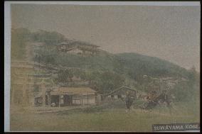
An entrance to Mt. Suwa

An entrance to Mt. Suwa

The torii gates of Suwa Shinto Shrine are on the left. The restaurant Tokiwaro, frequented by men-of-letters and politicians, is on the hillside. The observation deck above the restaurant commands a panoramic view of the city and harbour as well as Kii Peninsula and Awaji Island in the distance. The photographs taken from this spot appear in photograph albums, postcards, and guidebooks. The present-day Venus Bridge connects the original observation deck with a new one built above it.==Date:unknown, Place:Kobe, Photo:unknown, (Credit:Nagasaki University Library/Kyodo News Images) [Cabinet Number56‐33‐0]

  •  
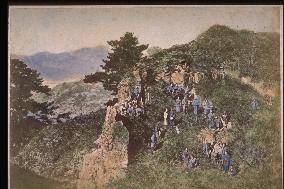
Kazagashira mountain

Kazagashira mountain

Mt.Kazagashira is located to the east of Nagasaki city, and famous temples line up along its foot. The graveyards behind these temples stretch up to the peak of the mountain. Before the Meiji era, many people came to enjoy the day on this hillside. There are many old photos of the view of Nagasaki harbour from the top of the mountain. At present, it is the Kazagashira Park.==Date:unknown, Place:Nagasaki, Photo:unknown, (Credit:Nagasaki University Library/Kyodo News Images) [Cabinet Number14‐47‐0]

  •  
View of hakodate city from hillside

View of hakodate city from hillside

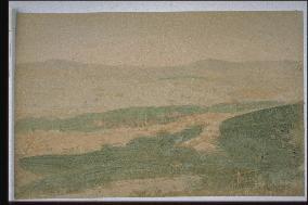
Hakodate city and harbour from the side of Mt. Hakodate. The colours are rough and have faded away, so the image is rather unclear. To the fore is greenery, the city, and the port and bay, and the mountains of Kameda peninsula can be seen in the distance.==Date:unknown, Place:Hakodate, Photo:unknown, (Credit:Nagasaki University Library/Kyodo News Images) [Cabinet Number12‐9‐0]

  •  
A view of the city of Onomichi

A view of the city of Onomichi

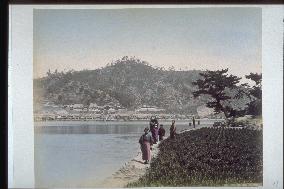
Mt. Jododera is seen from Mukoujima and Tomihama Beach on the south side of Onomichi Suido. Jododera Temple and Kairyu Temple are visible at the foot of the mountain. A man balancing a pole with containers of fertilizer on his shoulder and a mother and children are visible in the foreground.==Date:unknown, Place:Onomichi, Photo:Ogawa Kazumasa, (Credit:Nagasaki University Library/Kyodo News Images) [Cabinet Number9‐39‐0]

  •  
Houses of Togitsu

Houses of Togitsu

This is a view of Togitsu Village in Nishisonogi County adjacent to Omura Bay and Togitsu Harbour. The heavily populated Urago district is in the foreground, while on the opposite shore is the beach line of Sakino and its houses. This harbour was often used by people travelling to and from Omura. The hilly area in the background includes the villages of Okago and Urerigo. The tall mountain in the background is Mt. Sengo-dake.==Date:unknown, Place:Nagasaki, Photo:unknown, (Credit:Nagasaki University Library/Kyodo News Images) [Cabinet Number109‐39‐0]

  • Main
  • Top
  • Editorial
  • Creative
  • About Us
  • About ILG
  • Terms of use
  • Company
  • BEHIND
  • Price List
  • Single Plan
  • Monthly Plan
  • Services
  • Shooting
  • Rights Clearance
  • Support
  • FAQ
  • How To Buy
  • Contact Us
  • Become a Partner

© KYODO NEWS IMAGES INC

All Rights Reserved.

  • Editorial
  • Olympics
  • News
  • Sports
  • Japan
  • Tech
  • Royal
  • Disaster
  • NorthKorea
  • Old Japan
  • SNS
  • Creative
  • Food
  • Japan
  • Landscape
  • Animal
  • Popular
  • #Ukraine
  • #China
  • #coronavirus
  • #N. Korea
  • #Thailand
  • #Russia
  • #Ukraine
  • #China
  • #coronavirus
  • #N. Korea
  • #Thailand
  • #Russia
  • Food
  • Japan
  • Landscape
  • Animal
  • Olympics
  • News
  • Sports
  • Japan
  • Tech
  • Royal
  • Disaster
  • NorthKorea
  • Old Japan
  • SNS